National Tsunami Warning Center, NOAA/NWS
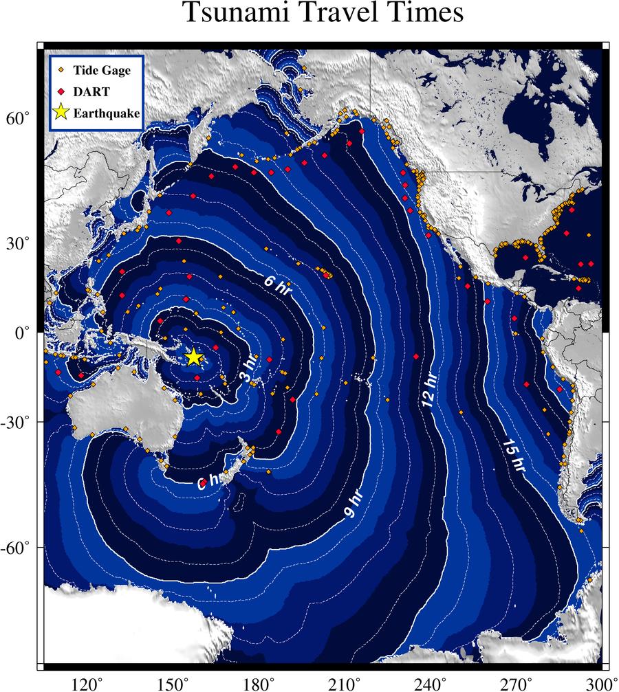
Solomon Islands Tsunami of 05 January, 2010
Two earthquakes occurred on January 5, 2010 near the Solomon Islands in the southwest Pacific. The first earthquake, magnitude 6.8 at 12:15:32UTC, was located at 9.056S, 157.585E and the second earthquake, magnitude 6.9 at 12:15:36UTC, was located at 8.886S, 157.522E (USGS parameters). One or both events triggered a tsunami, however, due to the close origin time and location of the sources as well as the small amplitude of the observed wave, it is not possible to distinguish between the events. The computed travel time is provided for the first earthquake.
The tsunami was recorded at tide gages monitored at
the Tsunami Warning Centers. Many observatories provide data to the centers; such as the NOAA
National Ocean Service, the U. of Hawaii Sea Level Center, the Chilean Navy, and the National Tidal
Facility in Australia among others. Click on the site name to see a graph of the tsunami, when
available. Listed wave heights are maximum amplitude in cm (above sea level). Observed Arrival time
is the actual tsunami arrival time in UTC on gages where it could be determined. The Computed
Arrival time is the estimated time of arrival computed at the National Tsunami Warning
Center (NTWC) based on the origin time and location. The Sample Interval column shows the time
between samples.
For additional information about this tsunami event see the Pacific Tsunami Warning Center's homepage.
|
Tide gage |
Peak amplitude (above sea level in cm) |
Observed Initial Arrival time (UTC) |
Computed Initial Arrival time (UTC) |
Initial motion |
Sample Interval (min) |
Data File (Julian Day Starts at 0000 UTC) |
|
3.0 |
1250 |
1252 |
down |
1 |


 Twitter
 Facebook
 YouTube
